Wärtsilä Navi-Harbour WebVTS 5.0 software application provides remote access to VTS / AIS tracking data to maintain full situational awareness, save time and costs. The system is designed to procure a more integrated view on the traffic situation in any area covered by existing Wärtsilä VTS or AIS monitoring system.
WebVTS works via standard Internet browser; the system is using AIS data sources, VTS Navi-Harbour, Navi-Monitor or AIS-Monitor target data.
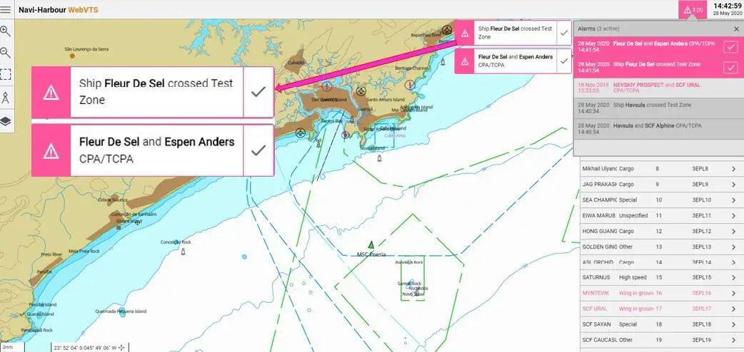
One of the best features of the WebVTS is the ability to show alarms for various traffic situations. The information and alarms are often used as a remote terminal by the Maritime Rescue Coordination Centres (MRCC) operators, marine pilots, bunkering companies, shipping agents and other Terminal / Port authority stakeholders.
The system supports simple traffic management tools, navigational maps, ship history, and works in various languages. As an option, WebVTS may be set to display Google Satellite images.

The 1st image shows how these alarms are displayed on the operator screen. The vessels stay close to São Lourenço da Serra, a suburban municipality of São Paulo in Brazil. The first alarm warns that the vessel Havsula is passing the test guard zone. Second alarm displays collision danger between two vessels, Ship Havsula and SCF Alphine.
The 2nd image alarm, again, alerts that ship is trespassing the test zone. Another alarm shows Ship Fleur de Sel and Espen Anders collision risk.
 Such decision support tools allow to mitigate potential risks, marine hazards and health issues for the crew; in other words, maintain full situational awareness.


