



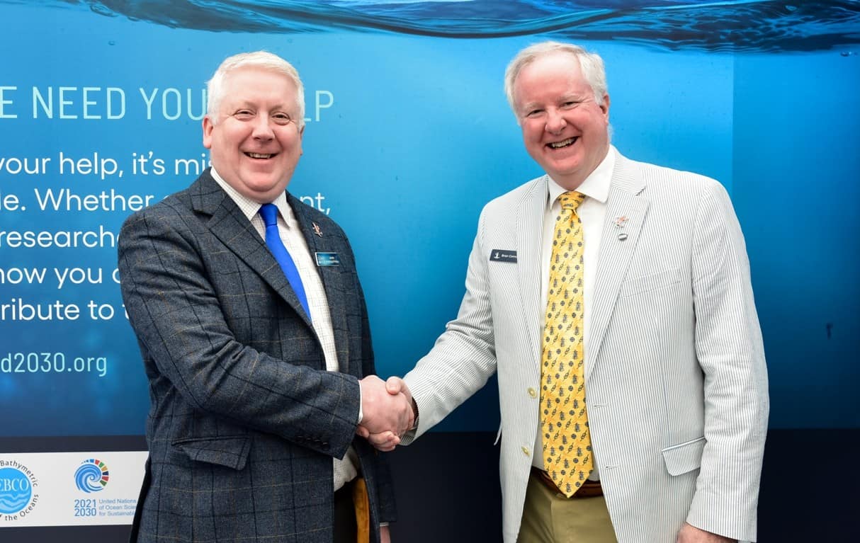
Saildrone, the world’s leading ocean data provider using uncrewed vehicles, and Seabed 2030 have signed a memorandum of understanding (MOU) to work together to advance ocean mapping in support of the United Nations Decade of Ocean Science for Sustainable Development. The MOU outlines a shared commitment between Saildrone and Seabed 2030 to leverage technological innovation to more quickly and efficiently collect ocean mapping data and support solutions for ocean mapping and bathymetric data management.
The partnership was formalized today in a signing ceremony during Ocean Business in Southampton, UK, an event connecting thousands of ocean science and technology professionals from across the globe to define the future of ocean technology.
Seabed 2030 is a collaborative project between The Nippon Foundation and GEBCO (The General Bathymetric Chart of the Oceans) to inspire the complete mapping of the world’s oceans by 2030 and to compile all bathymetric data into the freely available GEBCO Ocean Map. GEBCO is a joint program of the International Hydrographic Organization (IHO) and the Intergovernmental Oceanographic Commission (IOC) and is the only organization with a mandate to map the entire ocean floor.
“We can only realize our goal of a complete map of the ocean floor if we mobilize the international community and work together. We are therefore delighted to partner with Saildrone and leverage their expertise in unmanned surface vehicles for ocean mapping,” said Jamie McMichael-Phillips, director of Seabed 2030. “The capabilities of Saildrone’s fleet will greatly enhance our ability to obtain essential data and increase our understanding of the ocean. Allowing us, in turn, to make informed and impactful decisions with regard to the future of the planet.”
Accurate ocean depths and seafloor topography are essential for navigation, telecommunications, offshore energy, and understanding weather and climate, but only 23% of the global ocean has been mapped using modern, high-resolution tools.
Saildrone’s fleet of uncrewed surface vehicles (USVs) are designed to make ocean data collection cost-effective at scale, offering exciting new capabilities for ocean exploration and mapping. Surveyor-class vehicles carry a similar sophisticated suite of acoustic instruments to deliver International Hydrographic Organization (IHO)-compliant bathymetry data to a depth of 33,000 feet (11,000 m). Saildrone’s 33-foot (10-meter) Voyager-class vehicles are equipped for near-short ocean mapping to depths of 900 feet (300 meters). Saildrone platforms are the only USVs capable of long-endurance ocean mapping operations using renewable energy as the primary source of power.
“Saildrone’s vision is of a healthy ocean and a sustainable planet. A complete map of the ocean floor is fundamental to achieving that vision. We are proud to collaborate with Seabed 2030, to enable the mapping of our entire seabed, for the benefit of the global community,” said Saildrone founder and CEO Richard Jenkins.
All data collected and shared with the Seabed 2030 project is included in the free and publicly available GEBCO global grid.
About Saildrone
Navigating an ocean of data. Delivering a world of possibility.
Saildrone provides comprehensive turnkey data solutions for maritime security, ocean mapping, and ocean data. The company enables real-time access to critical data from any ocean on earth and uses proprietary software applications and machine learning technology to transform that data into actionable insights and intelligence. Saildrone’s fleet of uncrewed surface vehicles (USVs), powered by renewable wind and solar power, are designed to make ocean intelligence cost-effective at scale with a minimum carbon footprint. Saildrone vehicles operate 24/7/365, without the need for a crewed support vehicle, and have sailed almost 1,000,000 nautical miles from the Arctic to the Antarctic and spent almost 25,000 days at sea in the harshest ocean conditions on the planet.
About The Nippon Foundation-GEBCO Seabed 2030 Project
The Nippon Foundation-GEBCO Seabed 2030 Project is a collaborative project between The Nippon Foundation and GEBCO. The Seabed 2030 Project, launched at the United Nations Ocean Conference in 2017 by Chairman Sasakawa of The Nippon Foundation, coordinates and oversees the sourcing and compilation of bathymetric data from different parts of the world’s ocean through its five centers into the freely-available GEBCO Grid. Four Regional Centres cover the Southern Ocean, the Arctic, and North Pacific Ocean, the Atlantic and Indian Oceans, and the South and West Pacific Ocean. These feed data products into the Global Data Centre. The IHO Data Center for Digital Bathymetry (DCDB) serves as the long-term archive for Seabed 2030. Find out more about the project and how to get involved.






 to work together to advance ocean mapping in support of the United Nations Decade of Ocean Science for Sustainable Development. The MOU outlines a shared commitment between Saildrone and Seabed 2030 to leverage technological innovation to more quickly and efficiently collect ocean mapping data and support solutions for ocean mapping and bathymetric data management. The partnership was formalized today in a signing ceremony during Ocean Business in Southampton, UK, an event connecting thousands of ocean science and technology professionals from across the globe to define the future of ocean technology. Seabed 2030 is a collaborative project between The Nippon Foundation and GEBCO (The General Bathymetric Chart of the Oceans) to inspire the complete mapping of the world's oceans by 2030 and to compile all bathymetric data into the freely available GEBCO Ocean Map. GEBCO is a joint program of the International Hydrographic Organization (IHO) and the Intergovernmental Oceanographic Commission (IOC) and is the only organization with a mandate to map the entire ocean floor.)