Comprehensive analysis by maritime technology company Orca AI shows that its market-leading automated situational awareness platform achieved significant operational gains for clients in 2023, including a 172,716-tonnes reduction in CO2 emissions and fuel savings, thanks to fewer sharp manoeuvres and speed drops, as well as an overall reduction in the number of potential incidents and collisions avoided.
The analysis was carried out on 15 million nautical miles-worth of data collected in open waters by 267 customer vessels – comprising tankers, containers, dry bulk carriers and Ro-Ro vessels – equipped with the Orca AI platform.
With an increase of 26% in average minimum distance sailed, the fleet as a whole also saw an overall 33% reduction in close encounters in open waters and a 40% decline in crossing events.
Each ship experienced an average of two close encounter events per 1,000 nautical miles sailed. These were assessed against KPIs including closest point of approach (CPA), time to closest point of approach (CTPA), reaction time, average speed over ground (SOG), average cross-track error, and weather conditions.
“Achieving these consistent operational improvements from year to year validates our continuing vision to work in partnership with top-tier shipowners and operators to create a safer and more efficient shipping industry,” said Orca AI’s CTO and Co-founder Dor Raviv.
We remain committed to supporting our forward-thinking customers in ensuring safe navigation in congested waters, reducing the work burden on watch officers also during long voyages in open water, and reducing Opex costs thanks to reduced fuel consumption. Safety, efficiency and emissions reduction are crucial in terms of not only corporate sustainability targets but also maintaining CII scores for ships. We’re proud that our platform has become an invaluable asset that brings significant operational benefits at a reasonable cost,” Raviv added.
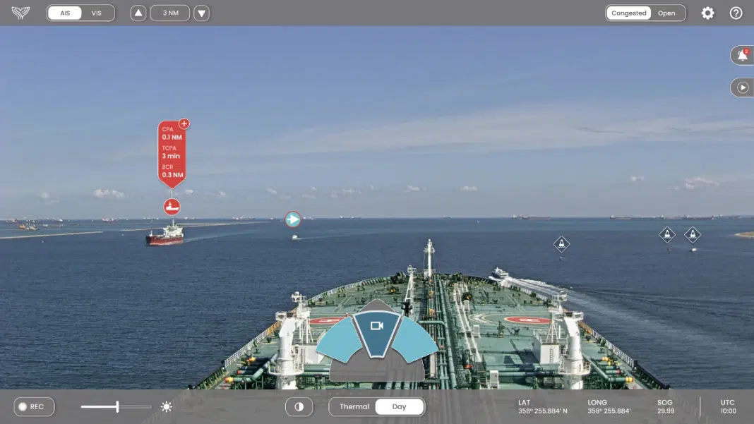
The Orca AI platform comprises the onboard SeaPod lookout unit which is equipped with high-resolution daylight cameras and thermal cameras providing an unmatched field of view (FOV) of 225 degrees. The computer vision data they generate is then fused with other sensor data from existing sensors onboard the vessel and displayed on a user-friendly interface on the bridge that identifies and tracks marine objects in real time, providing alerts and recommendations to support safe navigation. All events are available in real-time to shore via the FleetView platform. Fleet managers can also use the platform to spot trends, monitor navigational behaviors, investigate anomalies, and isolate events for training purposes.
“Using the platform enables vessel masters, officers and fleet managers to work together in a dynamic way to achieve tangible performance improvements for individual vessels and across a fleet. Reducing fuel consumption and emissions while mitigating the potential risk and costs of safety incidents, downtime and reputational damage is a win-win for all concerned,” Raviv said, “And we look forward to achieving even better results in the coming 12 months.”


