



TEXT: RACHEL PROBY PHOTO: WÄRTSILÄ
Traditionally, dynamic positioning systems rely on targets to keep vessels still and navigate precisely around objects like oil rigs and ports. Wärtsilä’s SceneScan – the first laser-based, target-less dynamic position system in the world – offers a better alternative
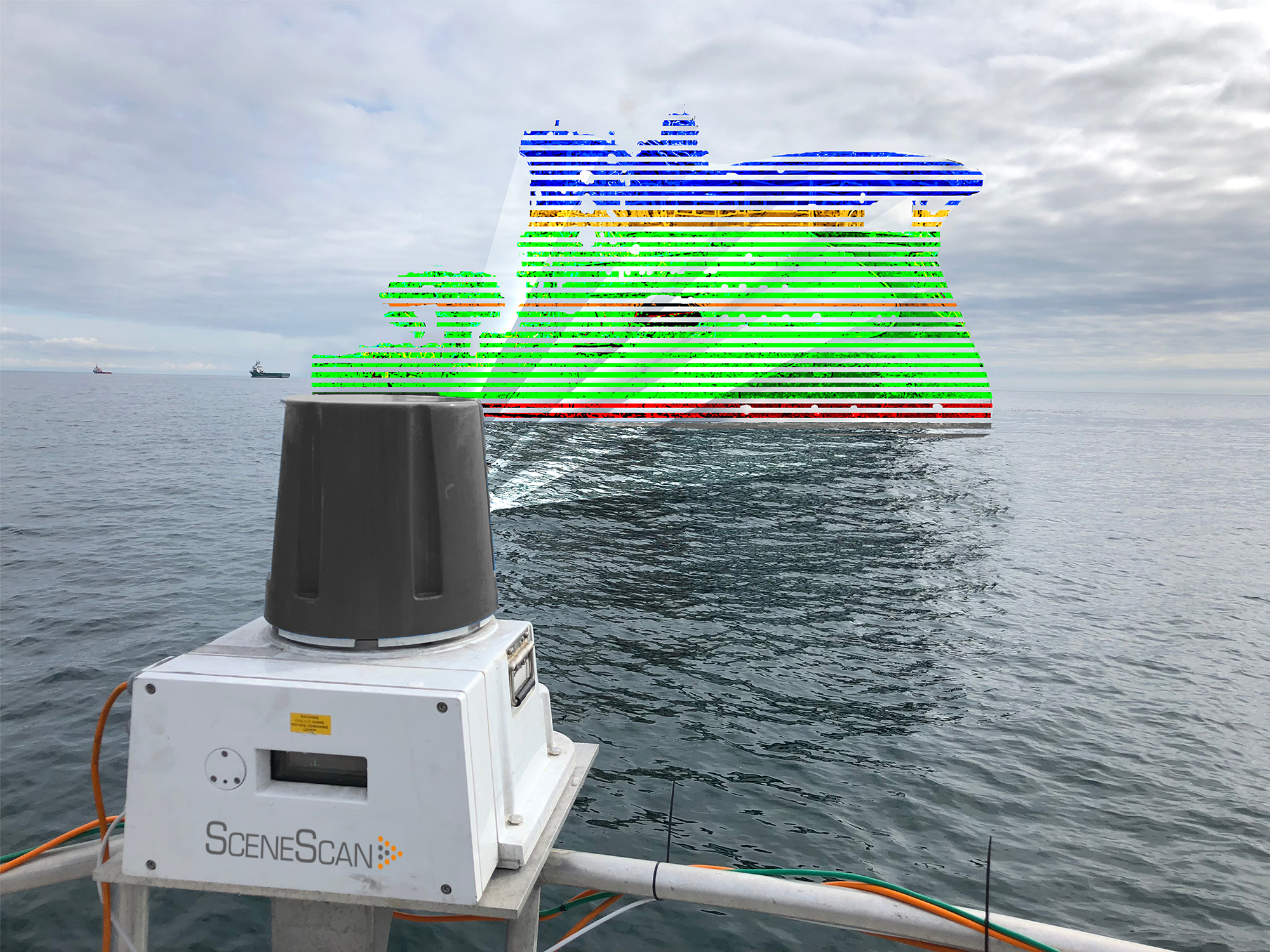
Dynamic Positioning (DP) systems are critical for many precision-driven tasks at sea. Unlike driving a vehicle on a road, there is no sure way to bring a ship to a complete and stable stop in the water, so these systems play a crucial role in helping ships remain still when necessary as well as move accurately around objects both in the deep sea and at port. Dynamic position reference systems have typically depended on targets, which are both limiting and expensive to maintain. Wärtsilä’s new SceneScan does not require any targets. Instead, it uses a high-accuracy rotating laser system that increases safety and improves efficiency.
“On a ship, you have a wheel to turn left or right, and an accelerator to go faster or slower. What you don’t have is brakes,” explains Hendrik Bußhoff, an Agile Business Development Engineer for Wärtsilä. “If you take away propulsion, you will drift somewhere. You’re at the mercy of the environment.”
This problem greatly complicates marine tasks where a vessel must remain still, such as work carried out on deep sea installations like drilling rigs. The vehicle’s position must be closely monitored, and the propulsion and steering constantly adjusted to keep it in exactly the right place. SceneScan makes the process far easier and more flexible.
The traditional model
Accuracy to within a tenth of a metre is often necessary for dynamic positioning, and conventional guidance systems such as GPS do not offer enough reliability alone. Additionally, GPS signals can be blocked, leaving a vessel essentially blind. This can be very dangerous during activities like drilling, and lead to accidents such as oil spills. Traditionally, dynamic positioning has required targets to be placed in a ship’s environment, which the ship can then interact with to find out its position. These could be a laser reflector or a radio beacon, or a subsea beacon that responds to sonar.
However, using targets creates specific problems. “You need to place these targets in your environment, you need to calibrate them,” Bußhoff explains. “They are expensive, they are out of your control, they have to be maintained, and you can only work around them. So, you have to shape the world to some extent, so that you can orientate within it.”
Mapping the future
SceneScan offers an alternative. “It lets you take the world as it is,” Bußhoff says.
The system fits on to a point on the ship — usually on or near the mast — and uses lasers to create a “map” of the surrounding area, which can be compared with previous maps. This system allows the vessel to be guided around the relevant asset (like an oil rig or a port bay). Bußhoff explains the technology by comparing it to that used by automated vacuum machines.“There are some of these little vacuum cleaning robots which have a little laser scanner sitting on top of them. They run around the apartment and they map it, and they can orientate through the space using their laser scanner,” he says. “That’s SceneScan. The only difference is that it’s not a vacuum cleaner, it’s a ship; and it’s not an apartment, it’s the world.”
SceneScan can be shipped directly to vessels and is easy to fit. First launched in 2018, Wärtsilä Guidance Marine successfully tested the SceneScan system at sea in April 2019. In December 2019, it received type approval from the DNV GL classification society. Then, in February, SceneScan won the Offshore Support Journal’s “Dynamic Positioning 2020 Award”. The award is a recognition of innovation in the dynamic positioning space.
What’s next?
For vessel operators and asset managers, removing the reliance on targets means lower costs, increased safety and far greater operational flexibility. Systems like SceneScan will therefore become increasingly attractive as dynamic positioning becomes more widely needed. Traditionally used by vessels servicing the global energy industry, dynamic positioning is now used by a variety of other sectors. One example is bunkering vessels, which supply fuel to other ships. Such vessels frequently have to navigate in between other vessels, which can show GPS signals and therefore confuse the positioning accuracy of the bunkering vessel’s DP system. SceneScan provides a reliable sensor even when GPS can’t be used and allows precise manoeuvring in immediate vicinity in the presence of other ships.
Further applications are likely in the future. As aquaculture becomes an increasingly important source of the world’s food, dynamic positioning will be needed on fish-farm support vessels. Similarly, as the renewable energy industry grows, it could help vessels service wind farms. Further ahead, it may also be required for seabed mining vessels and to guide automated or semi-automated ships. Innovative dynamic positioning systems will be crucial in helping the maritime industry adapt to new needs.